Camenca
Camenca (Camenca, Moldovan Cyrillic: Каменка; Каменка; Кам'янка) is a town in Transnistria, a breakaway republic internationally recognized as part of Moldova. It is composed of the town itself and the village of Solnecinoe. Camenca is the seat of Camenca District.
The town is located at 48.01667°N, 28.71667°W on the Dniester, in the north of Transnistria. In 1989, it had a population of 13,689. According to the 2004 Census in Transnistria, the town itself has 10,323 inhabitants, including 5,296 Moldovans, 3,476 Ukrainians, 1,305 Russians, 61 Belarusians, 42 Poles, 35 Bulgarians, 32 Gagauzes, 23 Germans, 10 Armenians, 8 Jews, 3 Gypsies and 32 others.
The mayor is Pyotr Mustya.
Polish–Lithuanian Commonwealth (1609–1672) Ottoman Empire (1672–1699) Polish–Lithuanian Commonwealth (1699–1793) Russian Empire (1793–1917) ?? Russian Republic (1917) Soviet Russia (1917–1918) Soviet Ukraine (1920–1924) Moldavian ASSR (1924–1940) Moldavian SSR (1940–1941) Kingdom of Romania (1941–1944) Moldavian SSR (1944–1991) Transnistria (de facto; 1991–present); ?? Moldova (de jure; 1991–present)
Map - Camenca
Map


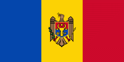
Country - Moldova
 |
 |
| Flag of Moldova | |
Most of Moldovan territory was a part of the Principality of Moldavia from the 14th century until 1812, when it was ceded to the Russian Empire by the Ottoman Empire (to which Moldavia was a vassal state) and became known as Bessarabia. In 1856, southern Bessarabia was returned to Moldavia, which three years later united with Wallachia to form Romania, but Russian rule was restored over the whole of the region in 1878. During the 1917 Russian Revolution, Bessarabia briefly became an autonomous state within the Russian Republic. In February 1918, it declared independence and then integrated into Romania later that year following a vote of its assembly. The decision was disputed by Soviet Russia, which in 1924 established, within the Ukrainian SSR, a so-called Moldavian autonomous republic on partially Moldovan-inhabited territories to the east of Bessarabia.
Currency / Language
| ISO | Currency | Symbol | Significant figures |
|---|---|---|---|
| MDL | Moldovan leu | L | 2 |
| ISO | Language |
|---|---|
| RO | Romanian language |
| RU | Russian language |
| TR | Turkish language |